Official media resources for journalists and content creators covering ShakeAlert®, the U.S. Geological Survey’s Earthquake Early Warning System.
IN A Hurry?
Press Contacts
Dr. Robert de Groot
ShakeAlert System Operations
USGS – Pasadena, California
rdegroot@usgs.gov | +1 626 372 3262
Quick Facts
What it is:
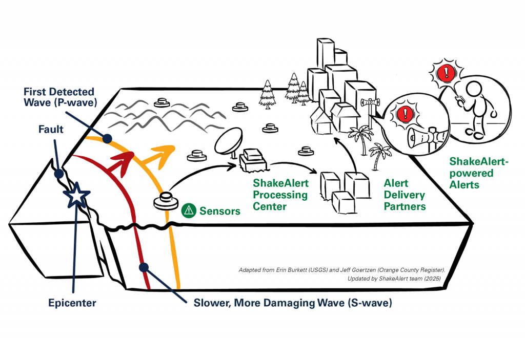
ShakeAlert is the U.S. Geological Survey-managed Earthquake Early Warning (EEW) System. It is the nation’s only public EEW system and serves more than 50 million residents and visitors.
Coverage:
Current coverage area: California, Oregon, and Washington.
Delivery:
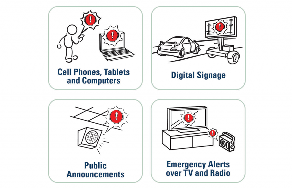
How alerts reach the public: Through the federal Wireless Emergency Alert (WEA) system, cell phone operating systems, smartphone apps, and automated systems used by USGS-licensed Alert Delivery Partners.
What it is not:
ShakeAlert does not predict earthquakes—it detects earthquakes and can deliver alerts seconds after an earthquake begins to those expected to feel strong shaking.
Key Messages
01
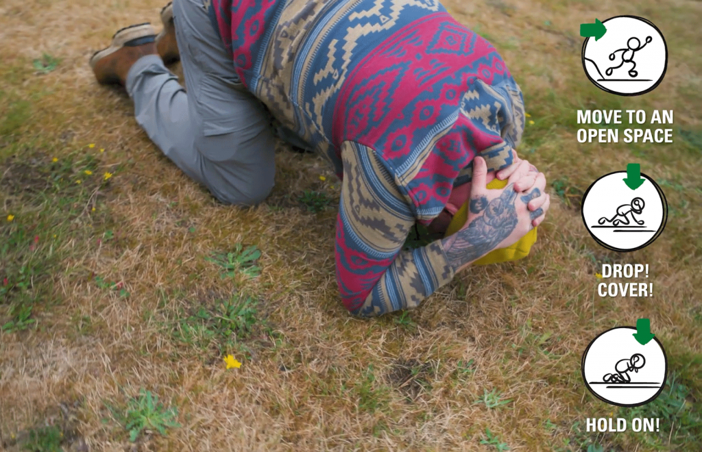
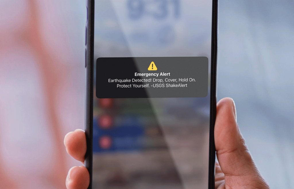
If you feel shaking or get an alert, immediately Drop, Cover, and Hold On.
Or take a modified action, depending on your situation.
02
Seconds matter.
ShakeAlert can give people time to protect themselves before strong shaking arrives.
03
ShakeAlert is not earthquake prediction.
It detects earthquakes and already in progress and issues alerts in real time.
FAQs for journalists
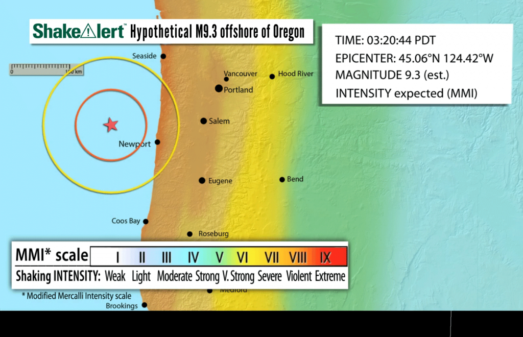
Typically, ShakeAlert provides a few seconds to tens of seconds before strong shaking arrives, depending on the alert receiver’s distance from the epicenter.
Videos, Animations, & Gifs
Footage for editorial use.
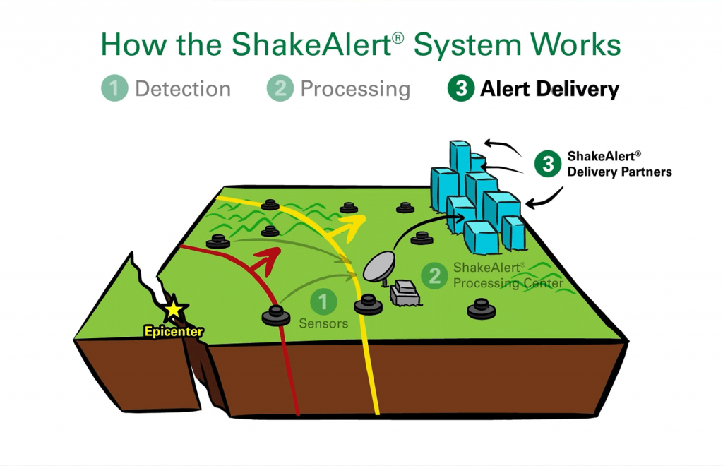
How the ShakeAlert System Works
Short explainer videos showing how earthquakes are detected, alerts are generated, and seconds of warning are delivered.
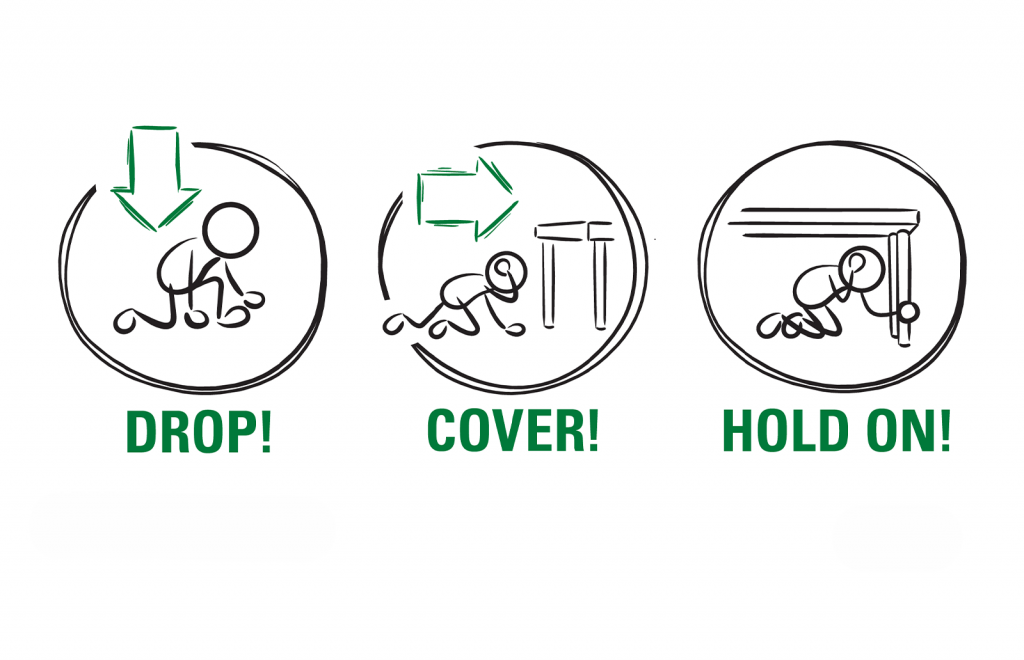
ShakeAlert EEW and Protective Actions
Videos showing ShakeAlert Earthquake Early Warning protective actions and modified protective actions for different settings.
ShakeAlert EEW in the Pacific Northwest
A regional explainer showing how ShakeAlert works in the Pacific Northwest and why earthquake early warning matters there.
Graphics & Photos
Logos and Brand Assets
ZIP file containing ShakeAlert logos and Trademark Quick Reference Guide.
Preparedness Graphics
ZIP file containing graphics for Drop, Cover, and Hold On, modified protective actions, and earthquake risk reduction strategies.
Alerts and Delivery Graphics
ZIP file containing graphics about ways to receive alerts, automated actions, and Earthquake Early Warning on your phone.
How the System Works Graphics
ZIP file containing graphics about alert thresholds, alert delivery, automated actions, and EEW on your phone.
WEA Alert Photos
ZIP file containing Wireless Emergency Alert screenshots and phone alert photos.
Case Studies
ShakeAlert in Schools: Stanwood Camano School District
ShakeAlert helps protect students and staff by sending earthquake alerts through it’s public address system.
ShakeAlert in Rail Systems: Metrolink
Metrolink implemented ShakeAlert-powered earthquake early warning alerts that automatically slow its trains to protect its riders, crew, and infrastructure.
ShakeAlert Goes Interstellar with NASA
NASA Deep Space Network’s massive antennas in Southern California are now protected by ShakeAlert. So are employees at the Jet Propulsion Laboratory campus at Caltech.
ShakeAlert in Water Utilities: City of Grants Pass
The city set up ShakeAlert-powered automatic closure of water system valves when earthquake shaking is expected to prevent massive water loss if a pipe is damaged.
Fact Sheets

Featured
Top 10 Messages for Newsrooms
- FAQ: ShakeAlert Baiscs
- FAQ: How to Become a Technical Partner
- FAQ: Cybersecurity and ShakeAlert System Resilience
- FAQ: The ShakeAlert Seismic Network and its Collaborators
- FAQ: Magnitude, Intensity, and ShakeAlert
- FAQ: ShakeAlert Earthquake Early Warning System and Warning Times
- EEW in the US and Canada – Nations Collaborate on Public Safety
English | French | Spanish
How to Get Alerts
ShakeAlert does not send alerts directly to individuals. Alerts reach the public through:
Wireless Emergency Alerts (WEA)
Cell Phone Operating Systems
Mobile apps authorized by USGS
Automated partner systems
Attribution & Partner Credits
Standard Line:
ShakeAlert is a U.S. Geological Survey product developed in collaboration with state, university, and private partners.
Partners Include: California Office of Emergency Services, Caltech, University of Washington, University of California, Berkeley Seismology Lab, Oregon Department of Emergency Management, and others.