
ShakeAlert® Field Technicians are integral to the ShakeAlert Earthquake Early Warning System
Keeping the ShakeAlert Network Strong
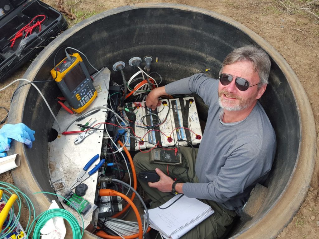
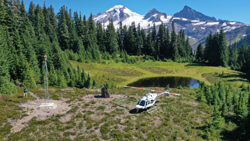
Seismic station installers set up, calibrate, test, and maintain the equipment that monitors seismic activity. They are crucial to earthquake monitoring and research, and contribute significantly to public safety and the scientific understanding of earthquake events.
Importantly, ShakeAlert Field Technicians are also “earth science/public safety ambassadors” who keep station hosts informed about the equipment on their properties, often using the resources available in this Field Tech Toolkit.
FAQS FOR STATION HOSTS
Hazard: What could cause harm?
Hazards are potential sources of harm or adverse effects. They represent anything that can cause injury, damage, or negative outcomes. An earthquake is a hazard because strong shaking can lead to personal harm (such as from falling objects or losing a foothold) and property/infrastructure damage. Aside from damaging shaking, earthquake hazards can also include landslides and soil failure. These hazards can lead to building damage/collapse, fire, and major disruptions to transportation systems.
Risk: What could the impact be?
Risk refers to the likelihood and severity of harm occurring due to a hazard. Risk evaluates the probability of an incident happening, such as an earthquake, and the potential consequences, such as personal harm or property/infrastructure damage.
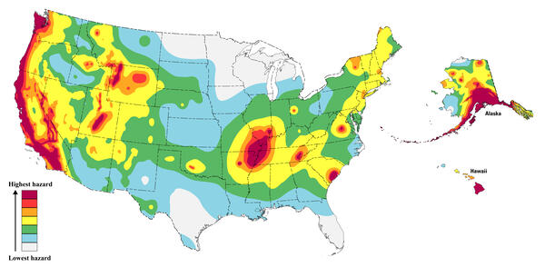
The West Coast of the United States is earthquake country!
Areas shown in red on the map have a greater than a 75% chance of damaging earthquake shaking in a 100-year period. For more information, visit the USGS Hazard Toolbox or the Risk Map, 2023 50-State Long-term National Seismic Hazard Model
What you experience can depend on where you are.
Washington & Oregon
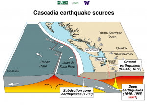
It’s possible you’ve never experienced an earthquake. Typically, the Pacific Northwest does not experience the more frequent, small earthquakes experienced near the San Andreas Fault. However, earthquakes and their cascading consequences pose a significant threat to the people, environment, infrastructure, and economy of the U.S. Pacific Northwest, which is along the Cascadia Subduction Zone, where two tectonic plates collide. A tectonic plate is a slab of solid rock composed of continental and oceanic lithosphere, or the earth’s upper-most crust and solid mantle).
(Source: usgs.gov)
Here, the Juan de Fuca Plate is thrust (or subducts) beneath the North American Plate. This region is susceptible to three types of earthquakes: deep (intraslab) earthquakes, subduction zone (megathrust) earthquakes, and shallow crustal earthquakes. For each of these earthquake types, earth scientists can use a variety of methods to estimate the probability of occurrence for future events, which constrains seismic hazard and informs building codes. Subduction zones are formed when Earth’s tectonic plates collide and one plate is forced beneath the other.
Historically, each of these earthquake types has caused significant damage to natural and built environments in northern California, Oregon, Washington, and southern British Columbia, Canada (referred to as “Cascadia”). The two largest earthquakes in recent years in Oregon, Scotts Mills (magnitude 5.6) and the Klamath Falls main shocks (magnitude 5.9 and magnitude 6.0) of 1993 were crustal earthquakes.
(Source: oregon.gov)
The timing of past earthquakes indicates that there is an 85% chance of a magnitude 6.5 (M6.5) or greater deep earthquake in the Puget Sound region; a 10-15% chance of an approximately M9 earthquake on the Cascadia Subduction Zone; and a 17% chance of a M6.5 or greater crustal fault earthquake in the Puget Sound region in the next 50 years. Individuals and communities can take simple steps to prepare for and reduce the impact of future earthquakes.
(Sources: usgs.gov Earthquake Probabilities and Hazards in the U.S. Pacific Northwest pnsn.org)
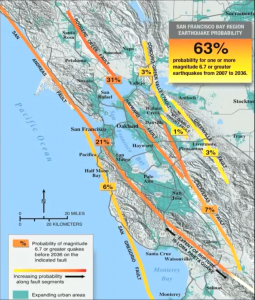
Northern California
A densely populated region on the West Coast, has a 65% probability for one or more M6.7 earthquakes or greater from 2007-2036. The 1868 estimated M6.8 earthquake in the Eastern Bay area along the Hayward Fault caused significant documented damage. Almost 40 years later, in 1906, a M7.9 earthquake struck San Francisco in the Western Bay area, where the surface rupture along the San Andreas Fault extended for almost 300 miles and caused enormous damage, large fires, and a significant loss of life. The M6.9 Loma Prieta earthquake of 1989 caused about $6 billion in damage and 63 fatalities, and exposed the strengths and weaknesses of modern building technology. Because the San Andreas and Hayward Faults run through such highly populated regions, it’s vital to be prepared.
Watch this video for more information.
(Source: Earthquake Probabilities and Hazards in the U.S. Pacific Northwest)
Southern California
Southern California has the highest level of earthquake risk in the United States, with half of the expected financial losses from earthquakes in the Nation expected to occur in southern California. Sitting astride the Pacific – North American Plate boundary at the Big Bend of the San Andreas Fault, Southern California has over 300 faults capable of producing M6 and larger earthquakes. Affecting the millions of people living in the Los Angeles and San Diego metropolitan areas, this complex set of faults presents the greatest urban risk in the United States.
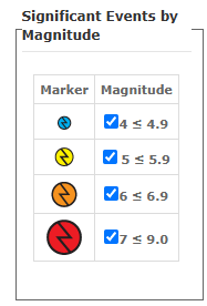
This map from the Southern California Earthquake Data Center shows historical earthquake events by magnitude and significant faults. Visit the site to select any colored icon to see specific information about each quake.
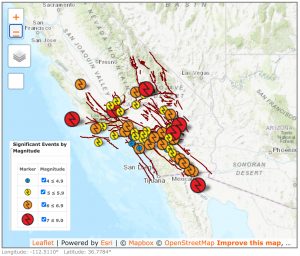
 (Source: usgs.gov)
To learn more about all recent earthquakes, visit this USGS earthquake map webpage.
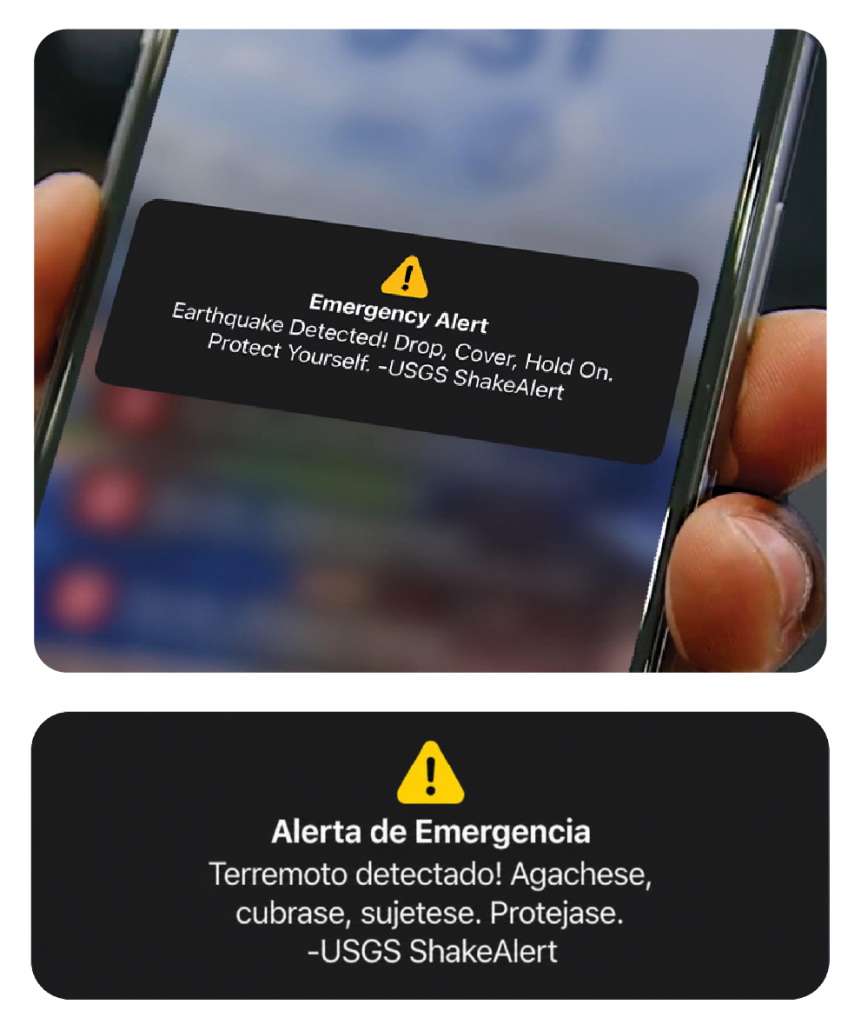
Alerts May Vary, but Most Include Sound, Vibration, and a Message
ShakeAlert-powered alerts may look or sound different depending on your phone, app, or delivery method.
- Sound: A loud or distinctive alert tone. Listen here.
- Vibration: A noticeable vibration pattern.
- Message: A short instruction such as:
“Earthquake detected! Drop, Cover, and Hold On.”
Alerts are delivered quickly—but not for every earthquake
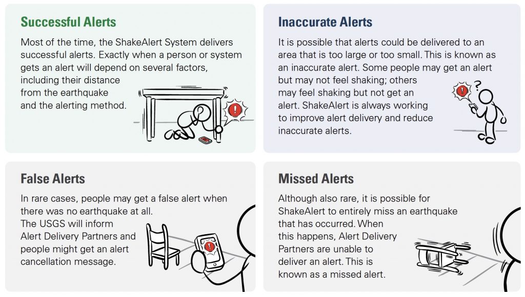
ShakeAlert Alert Delivery Partners are required to deliver alerts to people and ShakeAlert-powered automated systems in five (5) seconds or less after ShakeAlert data are generated by the USGS. However, alerts are not sent for every earthquake or to every device. Whether someone gets an alert depends on the estimated earthquake magnitude, the expected shaking at that person’s location, and the delivery method being used. Different delivery methods may use different thresholds. This is why one person may get an alert while another person nearby may not.
(Source: ShakeAlert Ready CERT training)
Distance is the biggest factor in warning time
Warning times depend on someone’s distance from the epicenter, sensor density, and the alert delivery mechanism (how someone gets alerts). Although ShakeAlert detects earthquakes seconds after they begin, there is a region near the epicenter of most earthquakes called the late-alert zone, where alerts may not arrive before shaking begins.
(Source: FAQ System and Alert Series – What Affects Warning Times)
Warning may range from none to several seconds
Some people may get several seconds of warning, while some may get very little warning. Some people may get no warning before shaking arrives.Warning times of up to 50–80 seconds is possible, but only under certain conditions for earthquakes located at considerable distance from those receiving ShakeAlert-powered alerts. The most important factor is distance from where the earthquake begins. People closer to the epicenter are more likely to feel shaking before they get an alert. The safest rule is to take protective action immediately if you feel shaking or get an alert.
(Source: FAQ System and Alert Series – What Affects Warning Times 2 of 4)
ShakeAlert Provides Timely Alerts, but Limitations Remain
So that timely alerts can be delivered to people and trigger automated protective actions, the ShakeAlert System uses about one second of earthquake data to estimate an earthquake’s location, magnitude, and shaking intensity. While the ShakeAlert System cannot predict earthquakes, it is committed to continuous improvement.
Alerting Take-Aways
- Be sure you can get ShakeAlert-powered alerts on your cell phone as a Wireless Emergency Alert
(WEA/like an AMBER Alert) and consider downloading other alerting apps (such as MyShake™). - Immediately take a protective action, such as Drop, Cover, and Hold On, if you feel shaking or get an alert.
- The ShakeAlert Earthquake Early Warning System will continue to improve to provide as much warning time as possible when strong shaking is expected at someone’s location. However, it cannot predict earthquakes.
Most stations have at least 72 hours of backup power
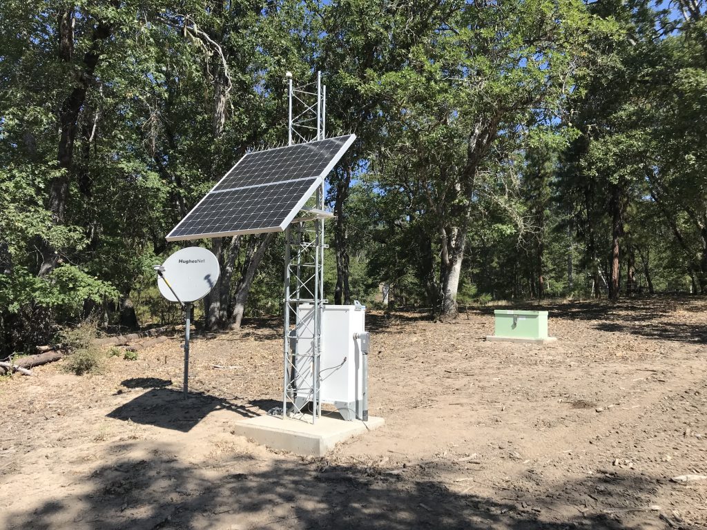
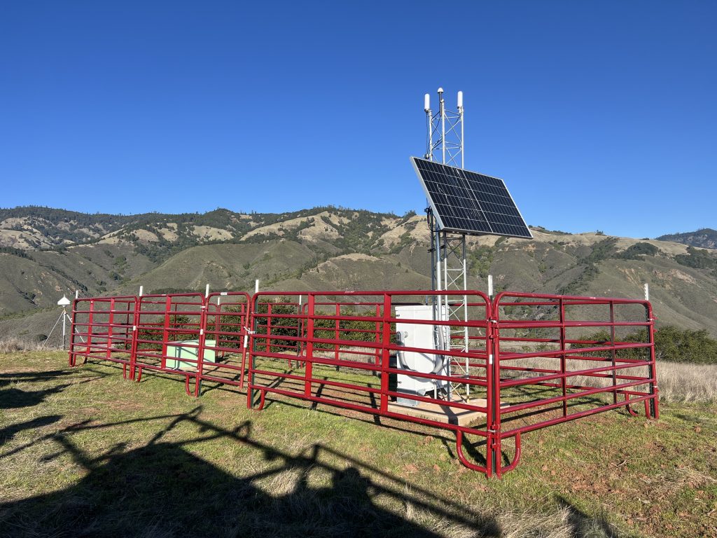
Most ShakeAlert seismic stations are solar-powered with battery backup designed to last at least three days (72 hours) during a power outage. After that period, a station would be expected to go offline unless power is restored, backup batteries are serviced, or a generator is deployed.
(Source: Revised Technical Implementation Plan for the ShakeAlert System (USGS OFR 2018-1155))
ANSS does not specify a required backup runtime
- The Continuity of Operations Plan section requires networks to have notification procedures for “significant network disruption” that lists “long-term power disruption” as an example of a disruption type — but it doesn’t define a duration or specify battery/backup runtime requirements.
- Post-event reporting requirements mention networks may need to report on “loss of infrastructure” affecting operations, but again without any specific power-outage duration standard.
ANSS focuses on network operations rather than individual station power
No station battery backup runtime, generator requirement, or outage-duration specification is mentioned in this document that focuses on installation guidelines, metadata/inventory reporting, earthquake product distribution (PDL, QuakeML), ShakeMap/ShakeAlert operations, IT security, and post-event reporting requirements, rather than physical power-resilience specs for individual stations.
(Source: ANSS Implementation Standards and Procedures V. 2.1_0)
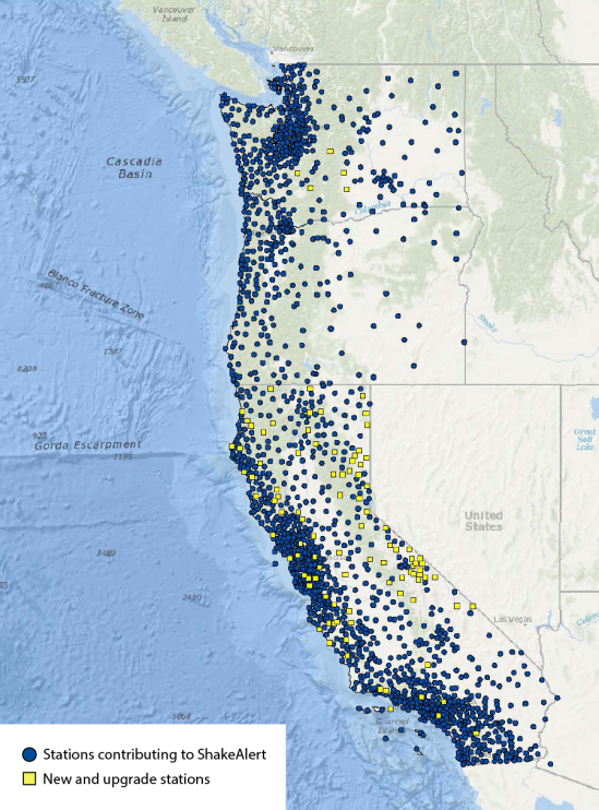
ShakeAlert station coverage
The graphic below shows the ShakeAlert Earthquake Early Warning System sensor density. (Note: This map is being updated but is very significantly complete.)
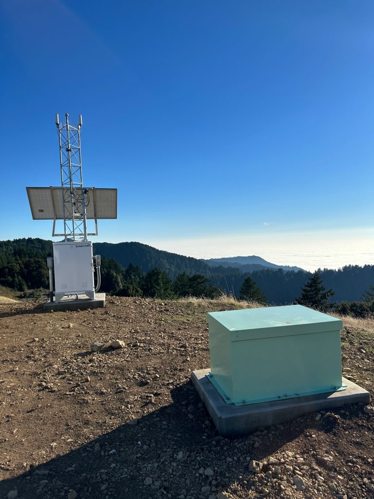
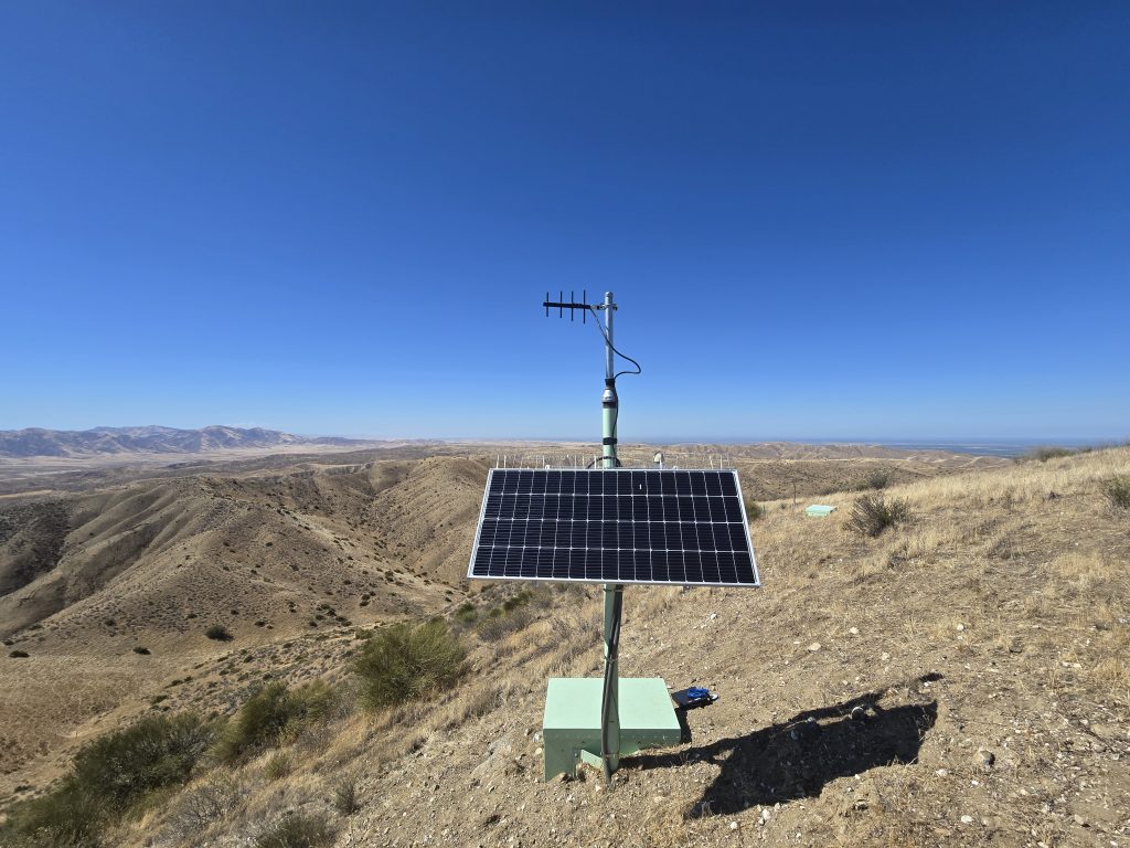
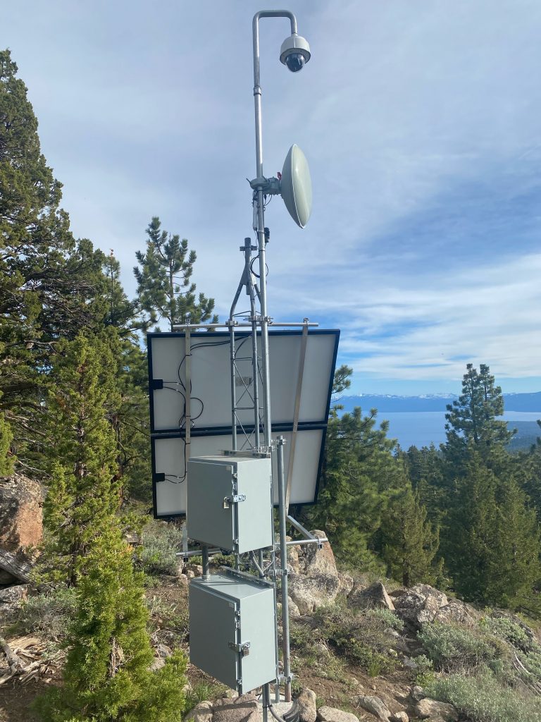
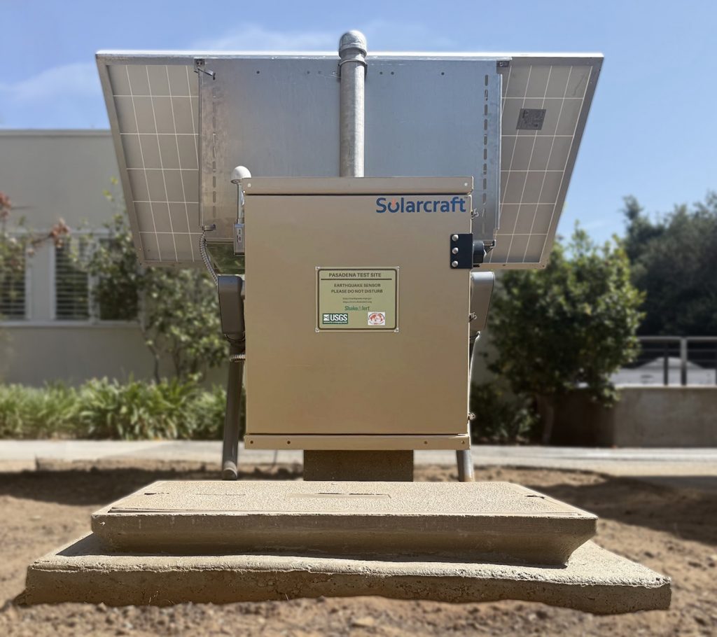
Stations Come in Different Sizes and Configurations
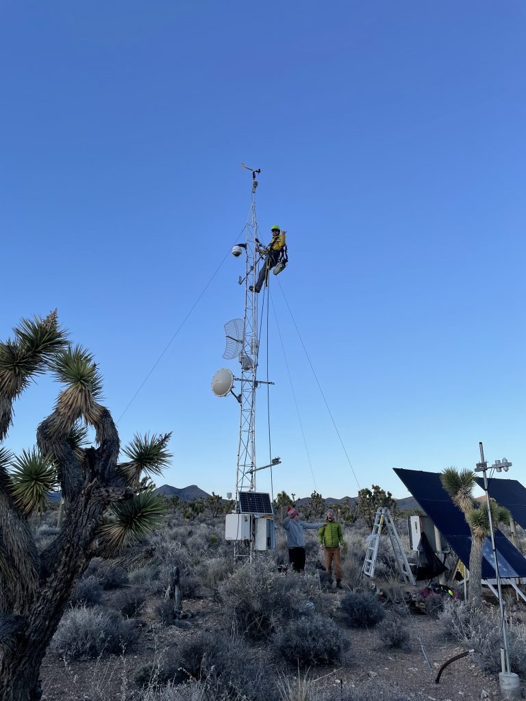
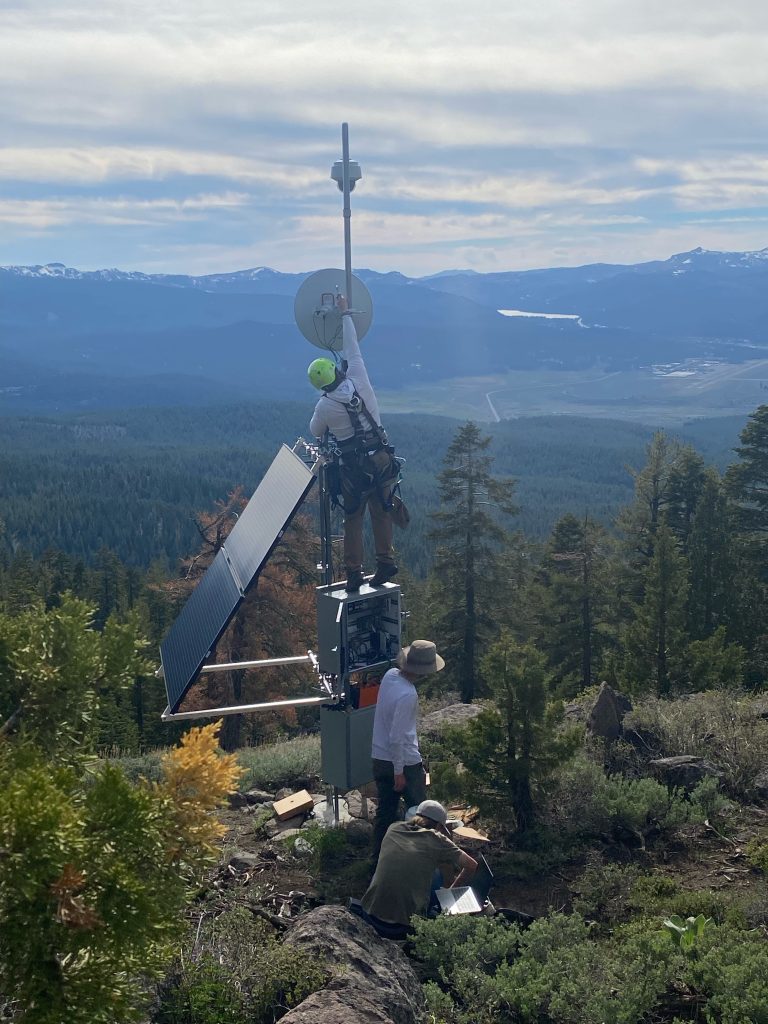
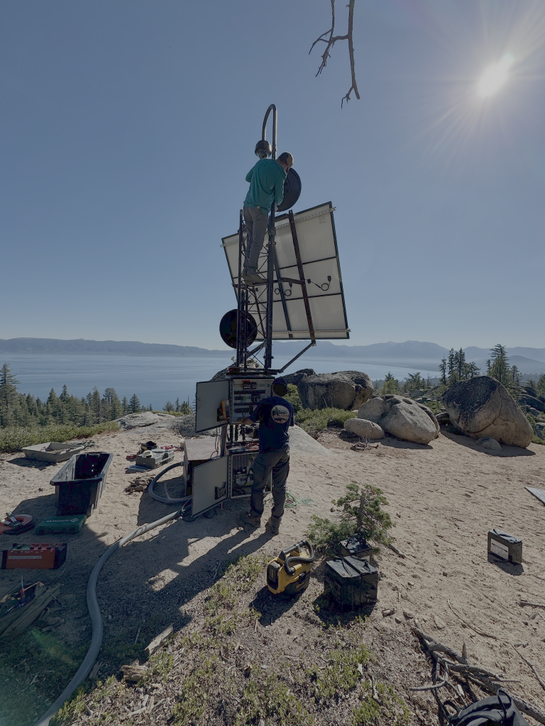
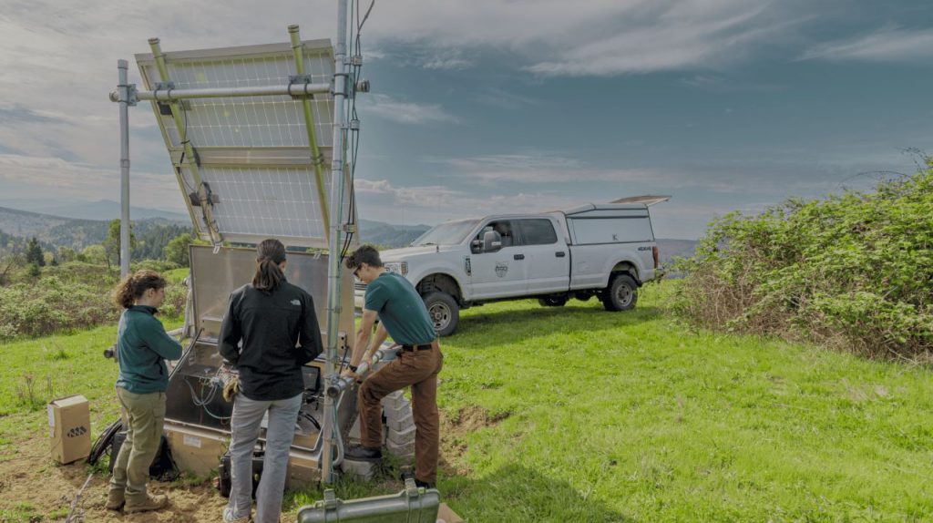
Compare typical large and small station layouts, then browse the photo gallery to see examples of stations in the field.
View Large Station Layout Diagram | View Small Sation Layout Diagram
Anyone Who Feels an Earthquake Can Contribute Valuable Data
Since 2004, the USGS has operated “Did You Feel It?,” a citizen-science program that collects accounts of earthquake shaking directly from the public. After an earthquake, people can go to the DYFI site, locate the specific quake they felt, and answer a short questionnaire that is scrubbed of personally identifiable information.
Questions ask what they felt, if they got an alert, how they responded (taking a protective action), if objects moved, and if there was damage. USGS aggregates those responses by area (ZIP code in the U.S., nearest city internationally) and converts them into a Community Decimal Intensity (CDI) value, using a weighted formula that is calibrated to the Modified Mercalli Intensity scale (showing how strongly shaking was felt across a region).
This mapped information can help to address information gaps between seismic stations, especially for smaller earthquakes or areas with sparse instrumentation. Not only can this information provide indications of ShakeAlert Earthquake Early Warning System’s performance, but can also help emergency managers understand continuing hazards, including aftershocks, landslides, liquefaction, and potential impacts to infrastructure and communities.
Sources: Did You Feel It?; Did You Feel It? FAQ; USGS Earthquake Information Tools for Public Safety – ShakeAlert
PARTNERS









RESOURCES
Download and share helpful materials for ShakeAlert station hosts.
Factsheet for
Station Hosts
COMING SOON
ShakeAlert
Station Sticker
Download PDF
Questions?
Contact your regional ShakeAlert Field Team.